
21 July 2014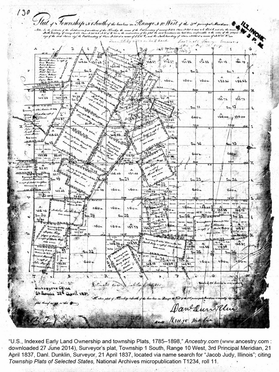
Today's image is a land map depicting part of early St. Clair County, Illinois. When you looked at it, did you say, My stars! What happened to Illinois? !
Historical researchers who use land records tend to mentally divide the United States into two classes:
- State-land states—i.e., the original 13 colonies, plus the 5 states cut from them. For these, we know that land grants are usually found in state-level records and we expect the land to be surveyed by metes and bounds, with squiggly plats running from a persimmon tree past Boggy Gut and down to Possum Creek.
- Public-land states—i.e., "everything else." In public land states, we know we should seek the land-entry files and patents at the federal level. We also know that public lands were surveyed under a nice 'n neat rectangular survey system based on ranges and townships that have 36 little squares.
Problem is: life wasn't that simple. Neither is our research. Many U.S. states are a hybrid of the two types. Those rooted in the English and Spanish colonies of East and West Florida, the early settlements of the Great Lakes, the Mississippi Valley (east of the Mississippi), the land embraced by the Louisiana Purchase of 1803, and the Hispanic Southwest all offer far more complex situations stemming from the fact that their land grants were originally made by England, France, Spain, or Mexico.
If your research in these areas focuses upon early settlements, many of the early grants will not be found in the U.S. Bureau of Land Management database. Much of the surviving paperwork may not be in the state archives or state land office. And the survey maps will definitely not be tidy checkerboards with 36 equally sized sections per township!
So: If any individual on this plat were a person of interest for you, where would you go for more information on his land?